Himachal Pradesh is a Himalayan state in the North-West of India and is known for its good performance in social and economic development indicators in the country. A state where the government seems to have ‘delivered’ in areas of education, health and other basic services. The region is also celebrated for its landscape- as the abode of snow and rivers that have always rendered the state a distinct identity. The lifelines of the region – Ravi, Sutlej, Chenab, Beas and Yamuna, the five river basins have sustained this mountainous frontier socially and culturally for centuries. Even today, the scenario seems somewhat idyllic and ideal – with a semblance of balance, with the State government being a good provider of welfare services and the mountain people co-existing peacefully with the landscape. However, a closer look reveals, that like in the rest of the country, there is a crisis in the making here. This crisis is unfolding as an environmental, social and economic one and is directly linked to a development model based on unbridled exploitation of natural resources for economic growth. And the impacts, considering the ecological fragility of the region could be devastating if the issues remain hidden and unaddressed. This featured map of the state, is an attempt to reveal some of the locations in Himachal where these impacts are being felt and where there has been some local response or conflict as a result of the projects undertaken in the name of ‘development’. While in the initial years (after the statehood in 1970), Himachal Pradesh’s state government evolved a model of development (ongoing) based on promotion and diversification of agriculture, horticulture and tourism based livelihoods, in the last two decades, the state’s economy has undergone a shift, stressing on generation of renewables, mainly hydropower, industrial development, mining and development of large scale infrastructure projects to facilitate commercial growth especially for the private players. In 2000, the state announced its commitment to become the “green state” of India, through fostering so-called renewable energy, clean industries, sustainable tourism models and other progressive policies. What on paper seemed like the ideal model turned out to be more of green-washing with an agenda for growth promotion.
Infact, the XII Five Year plan (2012-17) indicates hydropower as one of the energy pillars to sustain a “Faster, Sustainable and More Inclusive Growth” and in maximizing the share of renewables. The plan estimates hydro potential in India at about 149 GW including small hydro plants(less than 25 MW capacity), which makes “only the 32% of total potential”. And it finally identifies major part of the unexploited potential located in the North-East and Himalayan regions. The hydro potential in Himachal Pradesh has been recently assessed to be around 27,000MW in the state’s five river basins. Out of these, 9213MW have been already harnessed by private, central (Government of India) and state sector (Government of Himachal Pradesh). Most of them are planned under the run-of-the-river (RoR) scheme. RoR schemes entail water being captured at one spot, diverted into penstock pipes and finally released through turbines at the generation plant, at a lower elevation. Water therefore runs into tunnels inside the mountains and the rate and intensity of blasting has reached a point of severe social and environmental concern. Groundwater sources get depleted and often dry out completely, leaving entire villages without any drop. Moreover, road construction and land slides, seismic risk, diversion of forests, exploitation of migrant labour and poor working conditions, along with the disruption of local communities are other key ingredients of the Himalayan hydro boom. Nonetheless, the state government is blindly continuing with tapping the remaining potential quickly, through large, medium size and small hydropower projects. Be it drying up of large stretches of river and natural water sources, damages to houses due to intensive blasting, loss of crop, massive deforestation- all these stand ignored but the state government is undeterred and has gone forward to declare hydropower generation as future mainstay for its revenue generation. Moreover, the opening up of the sector to private and mixed (public-private) actors have further pushed for damming and diverting Himalayan rivers, as described by Dharmadhikary in his 2008 report “Mountains of Concrete” and “Global Finance” of 2002 by International Rivers, Urgewald and SANDRP.
Apart from the large scale hydropower construction, limestone mining and cement plants have emerged as another area of concern vis a vis its risks on local ecosystems and livelihoods. The severe environmental and health impacts for local people around the plants and mines are hardly a cause of concern for the government. Because of its vast limestone deposits, the state of Himachal Pradesh has over the last 20years attracted several private players like Jaypee,ACC, Ambuja, CCI, Aditya-Birla and Lafarge. Limestone accounts for 75% of the value of mineral production in the state. The boom in the real estate market and infrastructure development after 2002 has motivated cement companies to tap the Northern region’s increasing demand for cement, thus accelerating limestone mining and cement manufacture in the state. Apart from Limestone mining, stone quarrying has been another serious issue plaguing the state especially in areas like Nalagarh and Solan.
The 900 crore greenfield cement plant by French Multinational company Lafarge at Alsindi is a case in point. In 2003, the Bharatiya Janata Party, then in power, as a promise to boom the state’s industrial capacity, announced industrial subsidy packages to attract investors. The Lafarge Cement plant was proposed shortly after that but remains at the centre of controversy since day one. The project’s future currently hangs in balance as the local affected community took in their hands the responsibility of questioning its feasibility; its sheer magnitude, extent of mining involved and diversion of forest and private land in and around the project area. The local communities even went ahead and launched a legal battle. The cases of other disastrous units such as Jaypee where those living around the plant suffered with respiratory ailments was fundamental in shaping people’s responses against Lafarge in Alsindi village.
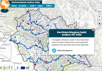
Though most hydropower and industrial projects in the state have posed some or the other kind of socio- environmental risks, however only in few strong local opposition was registered. This featured map, developed by the EJAtlas team shows the main socio-environmental conflicts in the state in the last 10 years around these projects. It identifies one conflict over a tourist project- the $ 300 million dollars worth Himalayan Ski Village, planned by the Ford family, two conflicts over cement plants by the French corporation Lafarge and the Indian giant Jaypee, and 16 conflicts over hydro plants across the five river basins, including the small hydro plants of Hul I&II.
Geographical information has been later added for visualizing extra information. Some more of the planned, under construction and commissioned hydropower plants are indicated with the red dots, warning about the pace of hydropower expansion in this Himalayan frontier. Here, hydro projects are geo located at the point of construction of the water diversion dam, but they should be understood as “connected dots” as water runs inside the tunnels dug in the mountains, aggravating the impacts of such mega infrastructure. Please note that some more could not be located so they don’t appear on the map. Furthermore, small plants below 25MW do not display either but they too have come up in hundreds especially on the smaller tributaries. Additional GIS data further helps visualize the main 5 river bodies of Himachal Pradesh plus the Spiti river and the main features for each basin, the level of water stress in the Himalayan region, the state’s districts with high population of “Scheduled Tribes” (tribal communities), the location of urban centres, and the snow covered areas for most times of the year. All information is being collected through official documents and reports, reports and articles by organizations and independent analysts like SANDRP and International Rivers, documentation obtained by Himdhara, a local environment action group, through the Right to Information Act and cross-checked with on-the-ground work and substantiated with interviews, newspapers articles and direct observations.
Featured Map : Himachal Pradesh
Mapping hydro schizophrenia and people’s resistance in the Indian Himalaya


